Showing posts with label Risk Assessment and Early Warning. Show all posts

Saturday, August 29, 2009

Reduction of Flood Risks and the Bicol River Basin

Approach:
  • Local weather data using home-based stations;
  • Weather and flood modeling;
  • Timely weather bulletins through SMS;
  • Novel information campaign on flooding.
DEVELOPING USER FRIENDLY RAIN GAUGES
THE NETWORK OF HOME-BASED STATION VOLUNTEERS:
Sends information to scientists via SMS

DEVELOPMENT OF A SOFTWARE (Satellite Image Picture Fetcher),
SMS Data Manager, Text Alert Console
DEVELOPMENT OF MODELS: Basin and Channel Flow
(Uses data from the community volunteers and other sources for analysis)
SIMULATION VS ACTUAL EVENT (Typhoon Dante)
During a simulation of the HEC-RAS analysis projected that at least 58mm of rainfall will lead to flooding in Central BRB. Typhoon Dante actually generated flooding in BRB with a minimum accumulated rainfall of 60mm.

SETTING UP THE TYPHOON and FLOODWATCH CENTER
in NAGA COLLEGES FOUNDATION: Sample Alert
Sends back information to communities at risk


Name of Organization

Manila Observatory

Implementing Partner

UP NIGS with assistance from COPE Bicol and UPCSWCD

Project Location

Bicol River Basin Communities (to be identified in the inception meeting)

Contact Person

Antonia Yulo-Loyzaga (Manila Observatory)

Dr. Carlos Primo David (UP NIGS)

Address

Manila Observatory Building, Ateneo de Manila University, Quezon City

UP NIGS, UP Diliman, Quezon City

Contact Number

02-4265921

Email address

aloyzaga@observatory.ph; cp.david@yahoo.com


Friday, August 28, 2009

Community-based Early Warning System in Agos River in General Nakar and and Infanta in Northern Quezon


EMPOWERING THE COMMUNITY TO TAKE THE LEAD IN PLANNING
AN EARLY WARNING SYSTEM


1. Participatory Capacity and Vulnerabilty Assessment (PCVA) was conducted to determine if the proposed project on Early Warning System will address the needs of the community.
2.Participatory approach was applied to ensure broad involvement not only of the communities but efforts were coordinated and partnership was established with the local government of Infanta and General Nakar
3. To ensure the participation of the LGUs, levelling- off with the MDCC of the two municipalities was conducted where roles and responsibilities were defined.
4. To incorporate science and technology in weather forecasting linkages with scientific agencies and institution such as UP – NIGS and local PAGASA weather station was instituted
5. Partnership with two local radio groups - KABALIKAT CIVICOM and BARCOM was established to assist in the development of communication system
6. To increase the awareness and raise the capacity of the population trainings on Disaster Risk Management were conducted on 16 participating barangays with the reactivation and strengthening of the Brgy. Disaster Coordinating Council (BDCC)

UNDERSTANDING THE RAIN AND WATER LEVEL: Installing Rain Gauges


KNOWING THE RIVER, HOW THE WATER FLOWS, HOW IT DRAINS

Installing water level measuring instruments in the Agos River

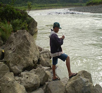
Measuring river depth, width, water height level
Understanding the rate of water flow
ESTABLISHING THE COMMUNICATIONS SYSTEM

Site selection for the repeater station
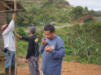
Installation of repeater and base station
Distribution of communication equipment with the help of KABALIKAT and BARCOM
Orientation on basic radio communication and formulation of a common language for emergency communications


Rainfall observation, observation of river conditions (i.e. color, force of flow, sound, debris movement, movement of current, water level) gets reported by the communities to the BDCC and the local disaster preparedness team. Data from the water level measuring station gets communicated through the repeater/base stations to the MDCC. Analysis is done in the MDCC by with the help of PAGASA and other experts from institutions such as the Manila Observatory. Official forecast is then communicated back to the communities in both the upper and lower end of the river through the communications system developed.

PERCEIVED VALUE OF A COMMUNITY-BASED EWS

  • Timely warning on evacuation of communities
  • Saving lives, livestock and personal belongings
  • Low capital and operational costs required
  • Establishes closer ties between communities, the government and the private sector.
  • Facilitated the development of other projects supporting flood disaster mitigation
  • Communities are better aware of their risks
  • Facilitates the understanding of the relationship between disaster risks and its impact on development of communities within the river system. As a result informed decisions are made on how the community can put their resources into better use.
  • An early warning increases lead time of communities to respond to threats
REFLECTIONS

  • Participation of communities are enhanced when they understand the value of an engagement
  • Engaging all stakeholders can also increase the asset-base of any community-based engagement
  • Community ownership of any community-based initiative is essential. This facilitate a more community-managed engagement.
  • It is possible to implement a high value project with less financial investment through efficient use of community assets
Slide 26
  • Slide 27

    Name of Organization

    Social Action Center Prelature of Infanta

    Location

    Infanta, Northern Quezon

    Contact Person

    Theodorus Van Loon (Deacon Mario) or Arnel Garcia

    Address

    Prelature of Infanta, Bishop’s Residence

    Contact Number

    042-5354213

    Email address

    sac_rin112904@yahoo.com

Sunday, October 12, 2008

INSTALLATION OF EARLY WARNING SYSTEM IN THE BARANGAYS ALONG AGOS RIVER IN THE MUNICIPALITIES OF INFANTA and GENERAL NAKAR, QUEZON

BDRC Pilot Project 2008-2009: SAC Infanta
(Infanta, Northern Quezon, Philippines)

Project Concept

The selected areas of project implementation are considered highly vulnerable areas that suffered the most in terms of human and economic losses during the last disastrous calamities in November 2004. Primarily, the reasons for these are the absence of clear disaster preparedness and response plan and efficient early warning system. Hence, the necessity to develop such a mechanism with the trainings on disaster preparedness and response is a significant factor to prevent the previous experience of the communities in dealing with disaster. The installation of a radio communication system to serve as early warning which is capable of reaching the whole community will improve monitoring and forecast information will guide the communities to the prepared disaster plan and response at the soonest possible time. The Early Warning System to be implemented is a community-based and people centered at local level. It is increasingly clear the necessity of a multi-hazard warning system that should represent a new way of thinking and ensures that environmental stability and local wisdom are built into disaster plans. The early warning system will make use of both low-tech and high-tech communication equipment. The batingaw or warning bells made from recycled oxygen tanks distributed in the communities will complement to warn the residents should there be a need to evacuate.

Basically this project includes water level measuring stations set up over key points in a watershed or its sub-station. Every station transmit its information in real time to repeater stations which are linked to a mother station where the data from all basins are received and processed and the change in water level at different points of interest can be closely watched. The basic elements of this system are a.) prediction; weather forecasting b.) detection-observation of rainfall and flood levels c.) communication – relay information to disaster agencies d.)decision making and e.) mobilization.

For the efficiency of the project, the early warning system must develop a standard actions to formulate an appropriate common messages easily understood by all the sectors in the communities. Consequently, the results of these will be integrated into the disaster preparedness and response training to be conducted to level-off the communities and all major stakeholders of the project.

However, in case of worst scenario that the radio communication system malfunctions or failed the only alternative warning scheme is the satellite cell phone that can relay and deliver a message in any disastrous event.

To have an added value and to maximize its purpose, it should be linked with the Manila Observatory and Philippine Atmospheric Geophysical and Astronomical Service Administration (PAGASA) for climate forecasting. The application of climate forecasting will complement the implementation of the agricultural project in the upland as well in the low-lying areas. The multi-purpose use of this project plays an important role to address the livelihood issues of the communities. Through the messages relayed by MO and PAGASA on the climate forecasts that will be transmitted to the communities the farmers will be able to determine what crops is suitable to plant prepare a farm plan.

To make this operational, vertical and horizontal communication and coordination between all stakeholders, with roles and responsibilities must be clearly defined and agreed. The local government units must also be included in all planning and training and will be recognized as key stakeholders in the project. The communities shall also be active participants in all aspects of the development, operation, training and testing of the early warning system. The local cable network and radio and the parish church have an important role to immediately deliver the news to the communities in case of any emergency situation.

This project shall primarily be implemented the by Social Action Center, local government unit and MDCC of Infanta and General Nakar, KABALIKAT Radio Communication Group and will be sustained by the Barangay Council, BDCC and community based organizations particularly Munting Sambayanang Kristiyano (MSK). In general, the whole households in the targeted communities will benefit from this project since it aims the development of preparedness disaster plan and response.


Project Objectives

Generally, the main goal of the project is to mitigate the impact of any disastrous calamities that may happen in the selected area through the installation of a systematic communication and early warning system alongside with the capability building of the brgy. officials and community leaders through the reactivation and strengthening of the BDCCs in the municipalities Infanta and General Nakar, Quezon along the Agos River.

Specifically it aims to :

• Strengthen risk management capacity of the barangays/communities along the Agos River by forming, training and strengthening response units and developing contingency plans.

• Installation and operation of early warning systems

• Coordinate efforts with the NDCC and MDCCs of the municipalities of Infanta and General Nakar and other organizations and institutions to establish social support networks on disaster risk reduction.

• To link with scientific agencies like PAGASA and Manila Observatory to received accurate and scientific data of climate forecasting

• To relay climate forecasts to the communities to prepare for the farm and determine crop to be planted.


Disaster Risk Reduction Strategies

1. Church-based NGO at the frontline with spiritual-based formation as the focal point for strong community participation and action.
2. Adopt a partnership with the national and local units and other major institution and entities as an approach to ensure the social protection of the community.
3. Installation of a multi-hazard warning system
4. Utilization of low-tech and high-tech communication system.
5. Linked with the scientific agencies such as PAGASA and Manila Observatory.

Home-based Early Warning Systems

BDRC Pilot Project 2008-2009: Manila Observatory
(Ateneo de Manila University, Quezon City, Philippines)

Project Concept

The problem with flood forecasting in the Bicol River Basin is that it is still at a regional scale wherein flood prone areas are designated on the sole basis of topography. While it is true that floodwater will eventually accumulate in the lowest part of the basin, the root cause of flooding is when streams overflow. A better approach then is to subdivide the BRB into individual river basins and evaluate every stream’s flood potential. Determining an impending river overflow can be done through monitoring the relationship between rainfall and flood height (from both historic and current data). Numerical modeling is also needed to constrain this relationship as well as current geohazard mapping for other weather-related hazards. Lastly, grassroots involvement through home-based stations (HBS) in this monitoring is imperative in order for local communities to recognize that scientific information is a vital component in their decision making process. This study aims to involve local experts and community leaders in scientific data gathering which eventually may form the basis of a localized early warning system for flooding.


Project Objectives

1. to constrain the rainfall-flood height relationship for various BRB rivers using historical data;

2. to set up a network of home-based stations within the BRB;

3. to set-up a floodwatch center in a partner university in the region;

4. to collect rain and flood information from the HBS volunteers on a daily basis; and,

5. to aid communities in incorporating the HBS network into their early flood warning system.


Disaster Risk Reduction Strategies

The relationship between rainfall and consequent flooding can be determined per river. Initially, rainfall intensity and duration data from PAGASA can be matched against historic river height. The use of numerical modeling can further refine the rainfall-flooding correlation such that later on one may be able to predict flood levels based on a given rainfall event.

Current mapping of river profiles and related geohazards (landslide-prone areas, stream blockage that may cause flash floods, etc.) will be continued. Thisinformation will likewise be transmitted to the communities involved.

A network of home-based stations (HBS) will have rain gauges installed within each sub-basin. This will also include HBS in the easternmost section of the Bicol peninsula (Catanduanes, Rapu-Rapu and/or Sorsogon) so that the rainfall volume from an incoming typhoon can already be established several hours ahead. An HBS will be designed for easy monitoring – the gauge will be installed in one’s roof which will be connected by a plastic tube to a graduated container inside the house. Data is sent via text messaging. An HBS for river height monitoring will be selected based on its proximity to the river being surveyed. Existing private and government weather stations can also be linked into this network. The information from the HBS network will be funneled in a local university floodwatch center which in turn can also update the network of prevailing conditions. It can also recommend predicted flood heights when needed.

Since the HBS network will be maintained by volunteers in the community, regular consultative meetings will be done to improve this methodology. Once this is perfected, it can hopefully be incorporated in their respective early warning system.